Discovering Moab Utah, Dream Destination Adventure
- Savvy Single Mama
- Jul 6, 2023
- 29 min read
Updated: Jan 3
Words can barely portray the magnificence of this dramatic city, which holds the vibe of exploration and discovery together as beautifully balanced as the rock structures which can't be explained. I present to you the Mother of all Blogs - this 3-4 -day adventure is a guide for anyone to use. If you click on an underlined link, it will connect you to the accompanying page, and I encourage you to click, enjoy and explore all of it.


Girls Tripping Around Moab - Thanks to these amazing women who said, "we're in" and trusted me to make an itinerary we would follow faultlessly ❤ And thank you to God our Most High Creator for sharing this amazing creation with us, getting us there safely, and home. We started our journey as we departed from an amazing Yoga & Art retreat in Colorado Springs. We stayed at the Glen Eyrie and visited the neighboring property, Garden of the Gods.
This itinerary could as easily be adjusted for families. However, as a mom who takes her children all over, I was extremely happy to not have any small children with me. Not only is the desert sun extreme, but Utah in general lacks guard rails and there are some serious cliffs/ slopes with no warning. As an adult, this was fun and exciting to navigate. I saw many children crying, on leashes (aka tether), and dragging along, they did not look like they were having fun. I felt for the parents. Also, if you are following this itinerary with a family the speed may need to be adjusted.
Moab has always been a dream bucket list. Red Rock Canyons, sweeping views, and breath-taking drastic colors – this landscape that looks like during creation God played balance the rocks as he designed these intricate shapes and formations with tons of personality. In June 2023 I hosted the Create Your Zen Yoga & Art Retreat, which ended with a girls trip to Moab Utah. For details about the amazing retreat, click here.
Where To Stay?
Moab is filled with Hotels and Airbnb options. We chose the Best Western.
I wanted a place that was centrally located, had great free hot breakfasts, and room for 4 to sleep (originally, we were a group of 4 girls) that would have a pool and be clean/ up to date.
I did get what I wanted. We had 2 Queens and a pull-out couch. We had a lot of luggage, and the extra space was definitely handy. Our room had a fridge and microwave, coffee pot and a great shower.
I recommend if you travel to pick a particular chain and beginning accumulating points. Often Hilton or Marriott has some great rewards for those going the points route! Prices in Moab can fluctuate depending on time of year and for this trip I booked 8 months in advance through Booking.com.
You will need a car!
While Arches National Park is right long the main road, most of Moab is VERY spread out. Even inside of the parks the points of interest are miles apart. This is not an Uber friendly or public transit kind of trip. We rented our car at Colorado Springs Airport and delivered it to Salt Lake City Utah airport, because this was a part of a bigger trip for us. But in any event, secure your vehicle ahead of time! There are so many campers and RV's everywhere I looked. For this trip I found the best deal through budget.com. At the time of my research I was having trouble locating a rental car - and this was 8 months in advance. Coming out of covid was the only explanation for a lack of rental cars.
Is this a budget adventure? $$$$$$$$
Your costs will be lodging, car, food, and National/ State park entry. If you chose to rent an off-road vehicle or participate in any of the other activities add that in. But the majority of your day will be spent hiking, in nature, and enjoying God's land, so this is extremely affordable once you work out those main four details. I suggest traveling with other friends to share costs, split expenses and not be out on these steep climbs alone!

Moab is just south of the Colorado River, at an elevation of 4,025 feet on the Colorado Plateau. It is 18 miles west of the Utah/Colorado state line. Via U.S. Route 191, it is 31 miles south of Interstate 70 at Crescent Junction. The entrance to Arches National Park is 4 miles north of Moab on US 191. Moab is located in the high desert of Utah and has a semi-arid climate with little rainfall and a wide range of temperatures. Winters are mild, but cold weather occurs between December and February. Temps typically dip into the 20s overnight and warm up to the mid-50s during the day. Summers are hot, they call it dry heat - what they mean is scorching! Temps often in the 90s during the day and hovering around 70 at night. The area typically sees around 300 sunny days each year, making outdoor activities an enjoyable option for most of the year. 🌞
Moab, Utah gets 10 inches of rain, on average, per year. (Good thing because if these hikes were slippery there would be a lot more casualties!) ☂
Moab averages 9 inches of snow per year. ❄
Moab has unique topography. The landscape and geology are something out of a Star Wars movie, with red rock spires that make no sense. Sure, there are some scientific explanations, there are also some descriptions that claim "probably" or "more research is needed". Sure water, time, erosion, wind - all of the elemental considerations matter in the rising and falling slick rocks. But the rocks here including thousands of arches and rolling domes of Navajo sandstone you just won't experience elsewhere.
When Dressing for this climate: check the forecast, and plan ahead! Must haves include good hiking shoes, socks, layers (mornings start cool but warm quickly) and sunscreen. The National Parks in Moab Utah are well known top destinations for many travelers! More and more people are Road Tripping to Moab as it is a part of an amazing loop of great bucket list sites in the southwest.
Let's Go - Itinerary:
This is the route we took. I am including the on the way in and out details in case any of this also applies to your trip. This is a 4 day/ 3-night plan, but if it takes you longer or shorter I feel these are great amazing things to see + do in any amount of time! Feel free to ask me if you are adapting your itinerary, or adding to another trip - See the Grand Canyon Adventure HERE.
Day 1 - Leaving Colorado Springs, The Scenic Route to Moab! We left Colorado Springs airport with our Ford Edge, taking the scenic Route. We drove through and often stopped for views in Lake George, Fairplay, Breckinridge, Vail, Avon, and arrived at Colorado National Monument around 7:15 pm. In our race to be back on the main road before dark we raced the sunset back down the side of the mountain.
We arrived at the Best Western in Moab after 444 amazing miles with good music, laughs and conversation. We checked in and headed back out to find something to eat - and on a Saturday night found not many options in the area. Luckily, we'd had a nice big lunch. But the girls opted for some Wendy's which was right next door.
Arriving in the National Parks of Utah, Road tripping to Moab!
Moab Day 2 - Today we will venture into Canyonlands (stopping at several places) and watch the sunset from Dead Horse Point State Park. - BRING WATER. LOTS OF WATER. BRING YOUR OWN SNACKS.

Canyonlands: We paid $55.00 at the gate for 7-day entry into all the National parks. I sadly left my America the Beautiful Pass at home.
While many venture in for sunset and head to Mesa Arch, we had a long drive to get here, and a busy day planned. We opted to take advantage of the free great breakfast spread at our hotel and take our time getting the morning started.
We started out at the Visitor's Center, which is a small museum. There is a video explaining some of the characteristics of the land as well as native species. The 3-D map in the middle of the room was awesome and helped me to affirm our stops (I already had some plans, but their display really concreted it for me) and the gift shop sucked me in! I was able to grab some souvenirs for the family since I felt a bit guilty being on vacation without them all!
The Island in the Sky mesa rests on sheer sandstone cliffs over 1,000 feet above the surroundings. Every overlook offers a different perspective with rugged terrain, layers of rock visible and colors that pop out of the earth. We stayed in the Island of the Sky section of the park on this visit and were able to experience amazing views! Our weather forecast was 99 degrees. And that sun was fierce! It was also gusty winds and we had sunhats that would not stay on our heads. One of the girls tried to use an umbrella to keep some shade and the gusts turned in inside out and it was swinging around like crazy! **It's a little crazy to be this close to the edge with our any railings in the wind. We were careful.
Our Stops/ Hikes:
Grandview - Grand Viewpoint lies at the southernmost end of the Island in the Sky scenic drive. From here, you can see the across miles of corrugated canyons, the White Rim four-wheel-drive road, features in The Maze and The Needles, and distant mountains. It's incredible to see how far the park stretches before your eyes. Just land. The hike is easy, 1.8 miles round trip. It didn't feel far, as the dirt and rock path is easy to follow and a lot of people are also on the trail.
Shafer Overlook - This was actually our first stop as we were going passed. It's a pull off of the road view point with a view of the canyon. Pretty, but we were excited to get to our day started and didn't linger long.
Green River Overlook - An easy stop, no hiking, just a short walk along a paved trail where The Green River can be seen meandering through the expansive Soda Springs Basin. The White Rim Trail can be seen far below. This point sits about 6000 ft. elevation, and you feel the height and depth. Ledges to walk along and different viewpoints paint the picture of the unique features in the earth.
Mesa Arch - The arch is right on the edge of a 500-foot cliff, part of a 1,200-foot drop into Buck Canyon. Peering through, you can also frame the awesome La Sal Mountains (usually snow-topped) with the arch. There is not much parking, but there are always people coming and going as the hike is .6 miles round trip and it is a loop trail. The arch is easy to access. Great photos can be taken from different angles. On this windy day I was shocked at the sudden drop off from the arch which sits on the ledge. As our first "real" site, this arch offers both a natural arch and canyon views that Moab is known for. Exciting to see. The ground around it is broken by rocky terrain that is easy to climb but still takes some navigating. Not steep, but definitely not flat! I was wishing my sneakers had a bit more grip!
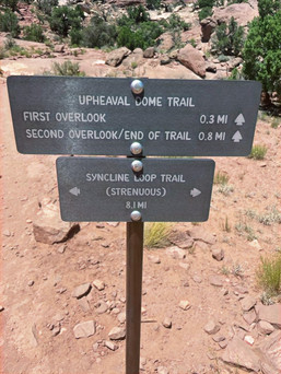
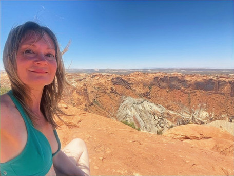
Upheaval Dome - This hike is a bit more work, considered "Moderate", 1.6 miles out-and-back and hard to follow in some places, you are hiking over and around a boulder. However, it's stunning to see. Some geologists call Upheaval Dome “the most peculiar structural feature in southeastern Utah.” The origin of the dome is the source of endless debate. For some mysterious reason, rocks formerly buried a mile underground are now on the surface in the crater. The two most common theories—the “salt dome” theory and the “meteorite impact” theory—are explained in a brochure available at the visitor center. I love how the sign reads "probably" caused by a meteor, which begs the question, "what happened to the meteor? Did it dissolve?". It was a hot walk up but also we all sat and marveled at this spot taking in the grandeur. Stunning colors, the pictures do not do it justice. This was our favorite (even though the most challenging) so far.
Goodbye Canyonlands!
After this we left to go back into Moab for lunch. We opted for Zax, and greatly enjoyed this choice because the environment was scenic, food delicious and they had these misters as we sat upstairs on the deck that cooled us off and didn't obstruct the amazing views of Moab.
We had a little time to freshen up before driving back into Dead Horse Point.
This is right across from Canyonlands, but we took the afternoon detour to get out of the heat a bit and spent a few minutes at the pool!
Dead Horse Point State Park for sunset
This park is not part of the National Park system, as it is a State Park, and charges $20.00 per car for entry. (Your other park passes don't work here). This is a 45 minute or 33-mile drive from Moab and located right before the entrance to Canyonlands.
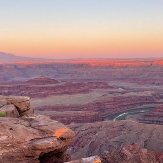
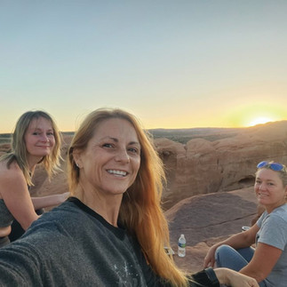
I asked as we drove in at 7:30 (sun was setting at 8:30) what was recommended. The park ranger said, "definitely make your way to the end for the sunset". I recommend arriving at least an hour prior to the sunset to be sure you are able to park, and also to just take in the amazing views. Watching the sun set is like moving colors along the edge of the rocks and the shadows and light slowly lift over the edge. The rock also creates these beautiful glowing reflections that hold so much warmth. I tend to think of rocks as cold and hard, but the sun has this beautiful relationship with them and you can feel the energy.
The best viewpoint occurs at the end of the road past a parking lot which provides the look out across a stunning landscape filled with buttes and mesas. Twisting through the canyon 2000 feet below the overlook is the Colorado River. From this side of the river, you are viewing the Islands in the Sky of Canyonlands, and this may just be the best viewpoint in the house. Similar to Horseshoe Bend in Page Arizona, this park gives you the view of the curve of the river which turns back around the corner quickly. Canyons, high desert woodland, and miles of trails invite visitors to explore, and this place fills up for a sunset moment that lasts a lifetime. As the sun sinks out of view the pink highlight lifts slowly off the rocks creating vivid watercolor paintings before your eyes. It's as if the rocks are all aglow!
While we were here on the edge of the canyon, I met a 6th grader who offered to take my photos. Her parents were doing their own photoshoot and she was chilling on top of a boulder with a basket of snacks and watching the wine. She told me how to pose and discussed her summer travels with me. They had flown in from Vegas and were doing all the parks. We tried to lift the drone, but the windy gusts made us too skeptical! People come and sit out all over the ledges bringing wine, snacks, tripods, and blankets making a full event out of watching the sun go down. As the sun disappears, the parking lot quickly empties. Definitely a great date night spot.
We knew we had sunrise planned for the morning and didn't have too long to linger. However, some people also watch the stars from this area. Personally, as the roads here are VERY dark without the sun, and the curves and elevations can be sudden, I am not comfortable driving here in the dark. I read some reviews of people who stayed too long and were very outside of their comfort zone when exiting the park.
At the end of this beautiful Sunday, we agreed each stop we made along this trip just kept getting better and better!
Day 3 -Arches National Park - Timed tickets are required if you enter after 7am or before 4 pm.
Reserve your tickets here: Timed Entry Reservation - Arches National Park (U.S. National Park Service) (nps.gov)
I felt like our Creator just outdid himself on this stretch of land.
Sunrise at Delicate Arch was simply one of those bucket list stops I knew I'd have to experience in my life. I am grateful beyond measure for this memory. This is the arch shown on Utah's license plates, and therefore the most recognizable.
We checked the time of sunrise - 5:55 am.
We knew it would take us about an hour to hike, and 15 minutes to get to the parking lot from our hotel. We awoke at 4:15, and left at 4:30 am. This was a roll out of bed, crab your tea/ coffee (DONT FORGET THE WATER) and go morning. Clothes were laid out. In the dark our starting temp at 58 degrees, and by the time we left to return it was 88. With the breeze there were some chilly moments starting out! We shed layers as the day warmed up. There were some parts of this hike that were challenging, but breathing and stretching first will make it easier.
The opening beneath the arch is 46 feet high and 32 feet wide, making it the largest free-standing arch in the park.
The trail to see Delicate is marked, but hard to follow in the dark in some areas. A few times we were off course. Luckily others were hiking and would call out the trail's location. Some have a head lamp. I found myself trying to climb up rather than hike around and more often than not finding a place to cut back over to the correct pathway. One of our girls went to the top where she could see the arch but there was no safe way to get there, so she came down and around.
It is 3 miles roundtrip and climbs 480 feet. The first half a mile is mostly on steps or sandy walkway. After that the terrain turns to sloped slickrock with no shade. Along this steadily uphill trail, you'll also pass the Wolfe Ranch cabin and a wall of Ute Indian petroglyphs, definitely catch the petroglyphs on the way back! Once you get to the huge sandstone domes, you are close. You're literally climbing in some areas. When you are almost there you'll pass a small arch in the cut out of the rock which gives you the strength to keep going. A few times I thought I'd never make it in time. Following along the curve of the canyon, which is steep, and narrow, you emerge on the front side of the archway and see the beautiful shape in view. The closer you get, the steeper the slick rock and narrower the ledge gets. It's stunning to behold.
We made it right in time for the sunrise.
How awesome to watch the colors and shadows moving over the rocks, especially after watching the sun go down a few hours before!
Look for the trail markers:
The night sky at 4:30 AM was not as dark as we'd expect. It had a beautiful dark blue hue and we were able to see a little. By 5 am it was much easier to see the trail signs.
Catch the petroglyphs on the way down! I love the history and culture here. Acknowledging the natives and the ancient Anasazi are a part of their story.
The parking lot looks so far away when returning. There are bathrooms at this parking lot and while all of the trails and viewpoints are spread out, this specific stop was well worth the miles and navigating! I can do hard things!!
Double Arch/ Windows
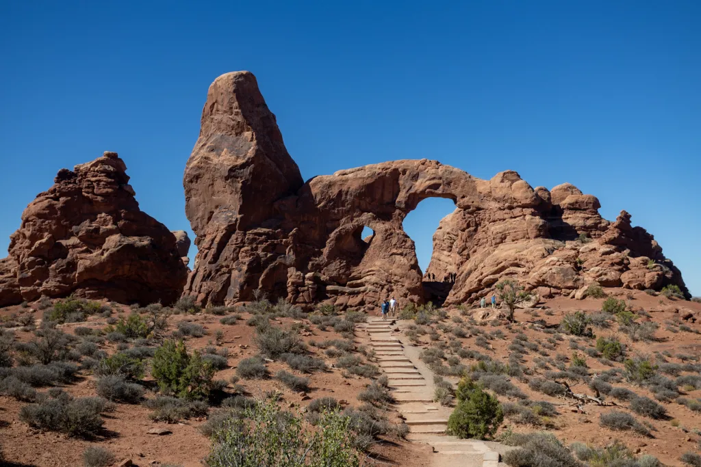
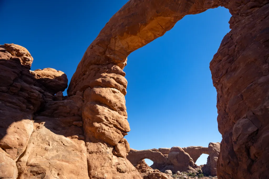
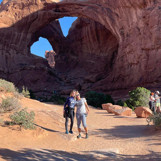
Our next stop along our journey was to the Windows/ Double Arch viewpoints, both of which are located in the same parking lot on opposite sides. You can walk across the way and see both arches from here. The short hike to the double arch was a nice way to mix up the morning from a strenuous morning hike (we earned that view) to an easy stay on the dirt path kind of hike, that felt like we won the lotto!
Now during much of this trip the Wi-Fi - signal of the phone was spotty at best. This morning I had a work call I needed to make at 8 am and this is where I found the strongest signal, so this was my office for 20 minutes!

Window's Arch - 12 miles from the entrance to Arches National Park. After passing Balanced Rock, turn right to the Windows section of the par. This will dead end after 2.7 miles at the parking lot for the Windows Trail. There are toilets, but no drinking water, so make sure you bring enough water with you. The trail is 1 mile to get to the window and has 100 feet of elevation.
The landscape here is dominated by interesting rock formations leading to a North Window and a South Window.
Double Arch - Visible from the parking loop at The Windows, Double Arch the tallest (112 ft) and second-longest (144 ft) arch in the park. A gently sloping path leads to its base. Of course the people who are inside of this arch have a completely different perspective; we were a bit worn out at that moment! We opted to return to our hotel for breakfast, then wash up and come back into the park. I will say the hotter it gets, the harder it is to really enjoy each stop. I am not sure in the summer how to make this more manageable but to say have plenty of water, good granola bars, or some other good hiking snacks to keep your energy going!
We had arrived in Arches National Park at 4:45 am and left at 8:45. In that time we saw some of the most stunning arches, and there was still more to do on our list I reserved our timed tickets for June in February - plan ahead.
*Breakfast back at the Best Western was divine!
*Showers felt refreshing!
We had planned to have a photo shoot and packed a dress to wear for the occasion - we also grabbed hiking attire to change into after.
Returned at 12 noon with very little traffic and were ushed in with our timed tickets, also showed our pass and ID.
Fun with our photo shoots at Park Ave. Park Ave is also a trail head and the people who were coming out looked victorious. Everyone said "don't hike down there in those shoes" as they passed by. We spun around in our pretty dresses and just enjoyed the magic of the moment.
Changed in the car and drove over to-
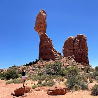
Balanced Rock - our yoga spot! This is one of only a few prominent features clearly visible from the road, right off the main driving road and 9.2 miles in from the park entrance. Standing at 128 feet high, weighing 3,577 tons, this is the largest of this type of structure in the park.
Devil’s Garden is located at the very end of the park road, 18 miles north of Arches Visitor Center. The drive time from the visitor center is approximately 45 minutes. It may seem far, but there is much to see along the route. Parking lots can be very busy during peak season and during holiday weekends. We must have been there at a good time, which was on a Monday afternoon, and we never had to wait for parking. At this spot, visitors find arches, spires, and a large concentration of narrow rock walls called “fins.” Fins are a new concept for me and occur when rainwater erodes in a vertical sandstone wall, making it look like a "fin" - This info will come in handy tomorrow when we ride the Fins and Things trail.
Landscape Arch is the monumental view of this trail and is found 1.9 miles in with hard packed surfaces to walk on. There is not much elevation gain, only moderate hills, up and down. The trail meanders through tall fins to a view of Landscape Arch. This was a HOT hike in the heat of the day and a few times we dumped water over our heads or tried to find a little shade. We filled our water bottles at the water station outside of this trail head. We each returned with no water left!
I don't think we hike fast, but we do keep moving. We were ready to head out of the park by 4 pm after having enjoyed ourselves immensely. two split shifts of 4 hours each and that's an 8-hour Arches experience!
Moab is fantastic. The culture and vibe here is so upbeat. We decided to check out the Sandbar Lounge for a drink and dinner with a view, and take it all in. Great choice. 80's music, good food and another upstairs vantage point fit the bill perfectly. This windy day many of the outdoor tables and chairs were laid sideways and the waitress led us to a spot that would be comfortable out of the sun and wind. The bar stools pull out and fold down, making this a really cute place. The people we came across in Moab were extremely friendly and wanted to be helpful. I didn't ever feel like an unwanted tourist.
We ended this day with a dip in the pool and some good laughs. Amazing day. Amazing experience.
Day 4 - Renting Off Road Vehicle, Side by Sides from Cliffhanger & Midway Point Hot Springs, Salt Lake City Utah
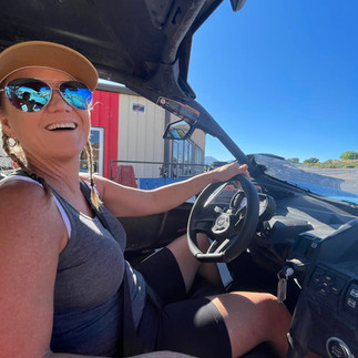
Picked up our off-road vehicle from Cliffhanger Jeep Rentals at 8am and planned for a 4-hour ride out in the trails.
This amazing adventure could not have ended any other way.
When you go to Moab, plan to experience the land in this manner - the way only Moab can show you. Rent a side by side/ 4x4. This is the REAL Moab.
This was such a planning process, and I made it way more complicated than it needed to be. I wanted the best deal. And I had questions. I started with Cliffhanger who was willing to share all their details and info. Some of my stupid questions consisted of:
If you can't ride through the parks, is there somewhere scenic to drive? All of Moab is very scenic.
Do you rent by the hour? No, none of the trails would really be done in an hour.
How fast can they go? Our can ams have a governor set for 45 mph. (Didn't like that, called around - but later discovered we never made it up to 45 mph lol - that is MORE than fast enough)
After reading online we learned the "best" trail to ride is called Hells Revenge.
When I walked up to the counter and signed all the safety legality forms (including agreeing there would be a $2000 deductible for any damage) they handed me the keys, and 3 pages of maps that connects through a line and said "have fun", I insisted we wanted to go straight to Hell's Revenge which we heard was the best. The guy looked at me calmly and said. "You may want to head over to Fins and Things first to warm up and get used to driving first, then go on over".
I responded, "How long is that trail" "9 miles". "Oh good then we can do that in like an hour and head to the good one". He said, "well it's gonna take you a while, you're climbing up the rocks, so it's gonna be a couple hours probably". I said, "Will we still have time for Hell's Revenge?" "Hells revenge is an out and back trail so whenever you are running close to time just turn around and come back.
Okay.
I took myself to the warmup course a little discouraged. Now I'm cracking up, I had NO idea lol.
Driving on the road in the side by side is 15 mph, then reaching the Sand Flats Recreation Entrance Station, we paid our $5.00 cash and drove on in. We switched to 4 wheel drive, and set the gear to low. Here we go!!!We thought we were going to ride sand dunes and race fast...
Fins and Things just doesn't sound like it's an intimidating trail. It sounds pretty run of the mill to me. On the rating scale it scored a 5/10 in difficulty, and honestly I didn't think this was anything to worry over. WOWOWOWOWWOWOWOW Let's go....
Fins and Things in Moab is an off-road trail in the Sand Flats Recreation Area in Moab, Utah. It is a one-way loop with an elevation gain of 1,095 feet. The trail is made of Navajo Sandstone Slickrock with some sandy areas along the trail. While driving some of the scenery is the snowy La Sal Mountains in the east, and on some parts of the trail, Negro Bill Canyon is visible to the west. Between miles 6 - 7 are some sweeping views of Arches National Park. This entire scenic drive is incredible. Trails are marked, but also markings are not always visible, and sometimes you lose the path and get back on it. Other times the path is the only way to proceed forward. The majority of the time we had the while place to ourselves. It was a Tuesday early in the day, not sure if that was a major factor.
We were feeling pretty victorious!
These tricky pathways can require some serious driving and as we warmed up to the vehicle, we couldn't believe the trails we were on!! Some very steep drop offs and rough edges. There were a few slicks we did not make it up - we quickly learned there is an art to crawling and this is not racing. This warmup trail was a lot of work!! The black tire marks serve as trail markers and how magnificent when you are riding out into the desert following the trail and exploring the terrain. There are some signs and mile markers spread out through the trail.
As we neared the end coming up on Kenny's Climb we watched a jeep full of guys pause and try to figure out how to maneuver to get up the steep incline. Watching them barely pull it off gave all of us anxiety! The jeep was slanted upwards. It slowly made it up over the slick rocks. We were just not ready to give that a try and started driving back along the one-way trail until we came to the alternative exit, and we were ready to exit! Once on the main road we were able to drive with more confidence. We could now see the road and appreciated being back on familiar ground!
When we pulled back into the parking lot they reminded us we needed to get gas and go by the car wash. They also told us we could skip the car wash, we kept it pretty clean! (LOL we were careful) We cracked up. But in any event, Cliff Hangers had amazing customer service and were calm, responsive, and extremely helpful. I highly recommend them. In my planning and asking questions stage they also referred me to another place to see if they had a different rate package (they didn't) but they just seemed like such honest people I kept coming back to them.
All I can say is I cannot believe what we did was legal, and it was the scariest fun I've ever had. 30 minutes in one of our trio said. "I don't want to do Hell's Revenge this is scary enough, I am not sure I want to finish, let me out" We did not let her out, and we all survived but this takes some real driving and navigating skill. We crawled over rocks, and crossed boulders, we completed the path (minus the option Kenny's Climb at the end)! We returned at about 11:30, and while we turned it in a little early, we absolutely got our money's worth. We did pay with cash and got the half day deal. I laughed and told the guy upon return that they need a warmup trail for that warmup trail. Apparently, there is one called chicken's crossing. I said we probably would have loved that one. In reality, I am so glad we did this. He also showed us the truck he uses to go out and clean up the wrecks and pull people out when they are stuck. That's a pretty common occurrence sounds like. They say stick to the trail, but sometimes you don't know where that trail is!!! We've never laughed so hard in our lives.
Of all the adventures - Moab is the king of the off-road trails and I hope if you are in the area, you experience this awesomeness.
We had requested a late check out - had a little time to shower, get it together and check out of the Best Western. Plan was to grab some lunch and then drive up to Salt Lake City Utah. We had an 11:45 pm flight back to Orlando, and a 5:30 pm hot spring swim in Midcrater. This would be our relaxing treat after the high energy adventure. We ate at the cutest little place on Main Street called Trailhead Eatery. First, we walked through a food truck plaza with misters and shaded seating. Lots of great options for food, drink and desserts! We felt like we needed more time to just eat and wander. The food was so well made at the Trailhead. Huge portions. A good variety of food and drinks.
Then we were back on the road, for our four-hour drive to SLC where we would soak in a hot spring. Another gorgeous drive. Everywhere we looked the mountains were stunning. At one point we drove right around the side of them.
Midcrater Hot Spring - We pulled up to Midcrater Hot Spring which is in a residential neighborhood, changed our clothes to bathing suits, waited outside of a random grated door, went inside at exactly 5:30, gave them our name and went right in to soak. They do follow a tight schedule. We all bought our own towels, okay I forgot my towel.1 hour of the mineral spring was so relaxing. I was already coming off of an amazing week. I'd flown into Denver for our Create Your Zen retreat and spent 4 amazing days in Colorado Springs prior to beginning the trek to Moab. I'd been riding a high of amazing energy, creativity, discovery, and wonder. All of the places I'd been wishing to see were checking checking checking themselves off my lists and my heart was full. I sank into the 95-degree water and felt surrounded by love.
This unique geothermal spring, hidden within a 55-foot tall, beehive-shaped limestone rock stays around 95 degrees. Above, the hole at the top of the dome lets in sunlight and fresh air which creates a vibe that yells peace and Zen. The water source is located 2 miles beneath the surface. Water flows through the crater at a rate of 135,000 gallons a day. While the water looks so clear, it's surprisingly 65 feet deep. Each person who enters is given a life vest to wear, and there is no age limit. It's quite the hot spot for scuba diving. This is the only warm water scuba diving location in the continental US! While we were there, we saw them training. This reminds me of the Devil's Den Spring in Florida, also an underground spring surrounded by cave walls, but that water is so cold! This was a treat. We swam and floated for an hour, and I don't know where the time went.
When you enter, you can use their changing rooms or already be dressed. (Already being dressed ensures you don't lose time floating). They have some shelves to store your belongings. Each person picks out a life jacket that fits them, and then you go hop in the water. There are some floating docks and ladders to help with that. The attendant at the desk said that at this time of year, the summer equinox, the sun lights up the water all the way down if you are there earlier in the day. We didn't snorkel, although some of the younger kids were. I may have like to open my eyes underwater, there are no fish or anything swimming. The longer we stayed in, the more we felt pushed towards the walls of the dome. When we asked why they explained that the scuba divers create oxygen bubbles, and that's what begins to move you towards the edges. Got to love water, it always finds it level! One of the managers came out after we were all settled in the water and gave us some of the history and facts. Beneath the water sits 8 to 14 feet layer of silt. The mineral rich water was built by trifa, or travertine, which is mainly composed of calcium.
The Spring has minerals in it which may be part of the reason for the relaxation. A mixture of Barium, Calcium, Magnesium, Manganese, Potassium, Sodium, Silica, and Strontium is perhaps what makes the water "feel" different. When I tell you I felt like it had some healing properties I mean all the muscles in my body felt relaxed. I had to get out of the water once just to drink water! I could have floated to sleep. There is a physical therapist who brings his patients there once a week for therapy. They also have paddle board yoga and the Scuba Certification available. I'd have loved a paddle board yoga class here!
We were an hour from the airport. As we got closer, we needed to gas up the rental car prior to returning and decided to eat. Looking for some salad and soup we popped an Olive Garden in Salt Lake City. Here we looked at our pictures, talked about the adventure and mentally prepared for the shift to go home.
Wow! A successful adventure in the books.

Affordability meter: 4/10
On a scale of 1-10 how affordable is this trip?
With 1 being utterly unaffordable and 10 being basically free, I rate this adventure a 4.
Moab is a pretty remote place and unless you live close, this is a hike for anyone. Shoot if you live close it's still a hike! All the places are far from all the places. It is vast. You really need a good vehicle to experience this land.
Gas was our main expense once we covered our accommodations, transportation and food. Most people will be flying in from somewhere and because I paired this with a flight I was already taking I did feel that double dipping saved me from needing to fly just to Moab. The closest airport is really SLC, but many people opt for the Vegas flight and see all of the things around that side. The parks themselves were not costly, but the entire adventure requires reservations and planning. Costs fluctuate greatly depending on the season you are traveling. I understand why people do the boondocking and BLM lands as an option to save money, you are really out in the middle of the free land! That being said it's a trip that is worth every single penny. The sights seen are distinctive to this area. My team of 3 split everything 3 ways, making this way more affordable for me than if I'd chosen to go alone or bring my family. This trip was 100% worth the time and money as the peace of nature nurtures the soul, and it is hard to find a day with higher value and less cost.
Our rental car ended up being $1100.00, Hotel apx. $800.00, Gas apx. $200.00, and food apx. $150.00 each. Of course, we had some snacks from the food store in the car, but we also like to eat well and were comfortable with this budget. Really this trip as an add on was a good deal.

Tips:
**Bring your America the Beautiful Pass - Cost $80.00
On this trip this pass doesn't pay for itself, but if you use it one more time during the year, it does. Many parks have a $30.00 or $35.00 per car fee, this pass allows unlimited access for the year to all National Parks.
*Pack sunscreen/ sunhat/ reflective/ protective clothes - Don't underestimate the power of the sun in the desert.
*Wear good footwear - sneakers/ hiking shoes will be needed. Much of the land is rocky and unleveled. My sneakers didn't have good grips and I felt like I was slipping at times.
*Bring a cooler - our soft cooler kept our waters cold and other drinks. We filled with ice from the hotel each morning and were so appreciative to have this. There are water refill stations as well and the water is cold, but a good cooler goes a long way.
*Drink more water than you think you need. Because we were coming from Colorado Springs and had already adapted to the altitude slowly, we were okay. But water is the way your body adapts to the elevation, and you'll be dehydrating quickly without it in the dryness which can bring on altitude sickness.
*Have your favorite lip balm. Have some lotion. Have something for the inside of your nose. Its DRY!!!! You'll need something to make you feel less scaly.
*Go explore. Bring your fun. Bring your joy. Touch the rocks, climb. Sit. Wonder. And just enjoy the beauty of the world we live in. Sometimes we forget to do that.

Budgeting tips:
Fixed Costs: Add up all of the balances that will be due for hotels and rental car (including deposit) and transfer that into a separate account/ credit card. Those are fixed costs. You can plan ahead for them.
Credit cards: If you get cash back on purchases, you may want to use that account (card) for the biggest/ majority of costs. You may also want to factor in a daily gas budget or food budget, transfer funds and swipe that card. But all of your expected expenses, that must be reserved for the necessities should not be available for other spending in the event that you accidentally spend more than expected in another place. Accumulating points or cash back can be especially rewarding when traveling!
Keep the necessity fund separate from the fun fund! I do bring cash for some things but try to stick with use of my card to keep track of spending and take advantage of points.

Wherever your travels take you, be sure to keep your presence in the moment.
Enjoy where you are at. Be a little flexible with people and their navigation of time.
Let go of things you can't control.
Remember to put your people above things, and cherish the memories.
Do things that will make you proud of yourself when you remember the scenario.
Live more, in abundance and walk in your own footsteps.
Please share your favorite things to do and travels tips to Moab with us! Feel free to leave a comment below.
I'd love to hear how you spent your time.
Thank you so much!
~ Mz. Savvy
Can't get enough?
All things in the Great Southwest:
If you have the time to continue exploring, Zion is also a must see.
Bryce Canyon is a two-hour drive from Zion, and can easily be looped into your day/ trip.
Back in 2019 when we circled the Grand Canyon we flew into Vegas and slept in a different place each night for 6 nights – our stops were 1.Tropic/ Bryce 2. Springdale/ Zion 3. Page/ North Rim, Water Hole Canyon, Horseshoe Bend 4. Kayenta/ Monument Valley 5. Tusayan/ Grand Canyon South Rim 6. Hemet, CA/ Joshua Tree, family
On this road trip excursion as a single mom of four on a teacher’s salary, I couldn't squeeze in Moab. The purpose of that trip was centered around the Grand Canyon and Moab was just a little farther out of the range and budget.
But once I had a taste of the Great Southwest it was just a matter of time before I’d return, Moab was already calling my name.
I was trying to plan Yellow Stone with a side of Moab! (Hours away)
Every trip I was planning for I was checking to see how far it was going to be to add in a Moab get a way. Finally, Colorado Springs was close enough that it made sense.
A note from the editor:
The information in this article was accurate when published but may change without notice. Confirm details when planning your trip.
I appreciate you stopping by today, please subscribe and share so we can stay connected.
My goal is to make traveling easier for families and cut down on the planning process. 💜
I specialize in helping families spend more time enjoying their quality time together and less time having to figure it all out. My four children have been my test subjects of how to plan a great family adventure for many years and now that my youngest is 18, many of my travels are work related, or grandma related! As time has changed, I've evolved but I still LOVE TO TRAVEL, explore, wander, visit, discover, learn and love. If nature is there, I can find my happy place. I use the term single not to emphasize my status but to signify that if I can manage some family fun on a limited teacher's salary with four children, anyone can do it. I am just very intentional in how I spend my time and earnings. I typically seek out budget friendly ways to enjoy my time, but will occasionally splurge for the right reasons :-)
Happy Travels!!
God Bless every road you travel on. xo


